Sheet 30 · Cotswolds Travel Guide · 16 min read
Best Cotswolds Walks for Visitors
The best Cotswolds walks for visitors, sorted by difficulty: easy village strolls, Cotswold Way day sections and fuller-day routes, with honest notes on
 Sheet 30
Contents 8 sections
The first time I walked out of Bourton-on-the-Water on a footpath instead of leaving by car, the whole place changed shape. Within ten minutes the tour coaches were gone, and it was just me, a clear little river, and a meadow full of sheep that couldn’t have cared less. That’s the secret nobody tells you on a day trip: the best of these famous villages lives in the half-mile between them, on foot.
If you remember only one thing, make it this: the best Cotswolds walks for visitors are short, gentle, and link two or more honey-stone villages, so you get postcard scenery without needing a map degree or serious fitness. Below I’ve sorted my favourite routes by how hard they actually are — easy riverside strolls, half-day classics, the best short sections of the Cotswold Way, and a couple of fuller-day options — with honest notes on distance, hills, and mud.
Quick Answer: What Are the Best Cotswolds Walks for Visitors?
For most visitors, the best Cotswolds walks are the easy village-to-village strolls in the northern Cotswolds: Bourton-on-the-Water to the Slaughters (around 5.5 miles circular, easy), Broadway up to Broadway Tower (around 4 miles round trip, moderate for the climb), and the Bibury riverside path along the River Coln. For something meatier, walk a day section of the Cotswold Way, such as Chipping Campden to Broadway (around 6 miles). All are well waymarked and need proper footwear after rain.
Here’s the honest truth I wish someone had told me sooner: you do not need to walk the whole 102-mile Cotswold Way to “do” the Cotswolds on foot. The day sections and the little circular loops are genuinely the prettiest bits, and you can pick them off one afternoon at a time. The harder, longer-distance stuff is wonderful, but it’s optional — and I cover where England’s bigger hiking lives over in the national parks hiking guide.
At a Glance: The Best Cotswolds Walks Compared
Distances and times below are approximate — I’ve rounded to keep them honest, because every blog seems to measure these routes slightly differently. Treat them as “around,” add time for photos and pubs, and you won’t go far wrong.
| Walk | Distance (approx.) | Difficulty | Highlight | Start point |
|---|---|---|---|---|
| Bourton-on-the-Water to the Slaughters | ~5.5 miles circular (or ~1.5 mi each way) | Easy | River Eye, Lower & Upper Slaughter | Bourton-on-the-Water |
| Broadway to Broadway Tower | ~4 miles round trip | Moderate (one steady climb) | Hilltop folly, huge views | Broadway village green |
| Bibury riverside (River Coln) | ~1–2 miles short, or ~6.5 mi to Coln St Aldwyns | Easy (short) / Easy–moderate (longer) | Arlington Row, Rack Isle | Bibury |
| Stow-on-the-Wold to Lower Slaughter | ~3 miles each way | Easy | Wildflower meadows, River Eye | Stow-on-the-Wold |
| Chipping Campden to Broadway (Cotswold Way) | ~6 miles one way | Moderate | Dover’s Hill, ridge views, Broadway Tower | Chipping Campden Market Hall |
| Stanton–Stanway–Snowshill circular | ~6.3 miles circular | Moderate (a few climbs) | Three storybook villages, Shenberrow Hill fort | Stanton car park |
| Bibury to Coln St Aldwyns | ~6.5 miles circular | Easy–moderate | Two villages, two pubs, River Coln | Bibury |
Before You Set Off: What Every Cotswold Walker Should Know
A few practical things apply to nearly every walk on this page. Get these right and the rest is easy.
Footwear and What to Wear
These are public footpaths across working farmland, not paved promenades. So: boots, not trainers, after rain. The ground here isn’t rocky — you won’t be scrambling — but the paths get genuinely, gloriously muddy, especially in field gateways, along riverbanks, and through woodland. A pair of walking boots or sturdy walking shoes with a decent lugged sole will keep you upright and dry. In high summer after a long dry spell, comfortable trainers are honestly fine for the short village strolls; the rest of the year, don’t risk it.
Beyond your feet, the English weather earns its reputation. Pack layers — a long-sleeve top, a warm fleece, and a packable waterproof jacket even on a sunny morning. I’ve been rained on in July and basked in October; it genuinely goes either way. For a fuller kit list, see my packing checklist.
Navigation, Maps and Waymarking
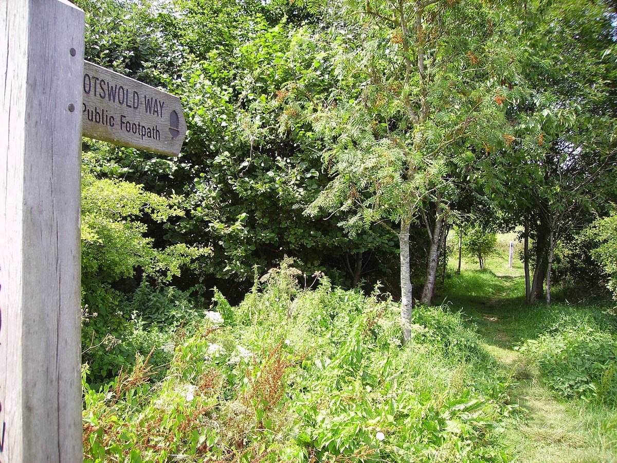
The good news for first-time visitors: the main routes are well waymarked. The Cotswold Way carries a distinctive white acorn symbol on posts and signs, and the official circular walks branching off it are signed too. Village-to-village paths are generally clear, though waymarking on the smaller field paths can be patchy where a signpost has been knocked over or a footpath crosses an open meadow with no obvious line.
I never set off without one of two things. Either the OS Maps app (the official Ordnance Survey one) with the route downloaded for offline use, or a third-party route from AllTrails or komoot loaded on my phone. Mobile signal is spotty in the valleys, so download before you leave the village. If you like paper — and on a longer day I do — the relevant OS Explorer maps (the OL45 and 179 sheets cover most of the popular northern area) are the gold standard.
When to Go and the Mud Question
The classic walking season runs roughly April to October. May and September are my personal sweet spot: long enough days, mostly settled weather, and noticeably fewer crowds than the July–August peak. Spring is lush and green but can be wet underfoot well into May. Autumn turns the beech woods spectacular, but expect mud and shorter daylight — start early.
Winter walks can be magical and crowd-free, but the fields turn to clay soup, some riverside sections flood, and you’ll want waterproof boots or even wellies for the boggiest stretches. There’s no wrong season; there’s just being honest with yourself about footwear and timing. For the bigger picture on weather and crowds, my best time to visit England guide goes month by month.
Dogs and Buggies
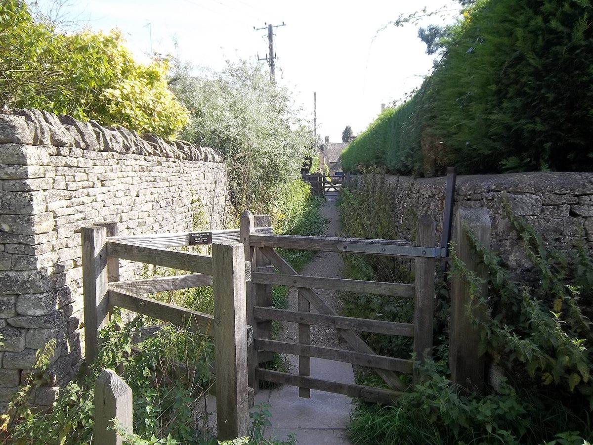
Most of these routes cross farmland with livestock, so dogs must be on leads near sheep and cattle, and you’ll meet plenty of stiles and kissing gates. The Slaughters and Bibury strolls are the most dog-friendly. Buggies are trickier: the through-village pavements are fine, but the moment you hit a stile or a muddy field gate, an off-road buggy struggles and a city stroller stops dead. For the easy linear village walks (Bourton to Lower Slaughter, the short Bibury riverside loop) you can often make a buggy work in dry conditions; for the circular field routes, I’d leave it behind. Travelling with little ones changes the calculus a fair bit, and I’ve gathered the family-friendly attractions and softer options in the Cotswolds with kids guide.
Easy Cotswolds Walks: Village Strolls Anyone Can Do
These are the easy Cotswolds walks I send first-timers on. Minimal climbing, maximum scenery, and you’re rarely more than a mile or two from a tearoom. Perfect if you’ve got a couple of hours, a non-walker in the group, or you just want the postcard without the puff.
Bourton-on-the-Water to the Slaughters
This is the one I’d do if I could only do one. From the much-photographed low bridges of Bourton-on-the-Water, a clear footpath heads out past meadows to Lower Slaughter — around 1.5 miles each way if you simply walk there and back, which is the gentlest option of all and lovely for families.
To make a proper outing of it, do the circular route that loops up to Upper Slaughter too: that’s around 5.5 miles and takes most people roughly two and a half hours at an amble. It’s flat to gently rolling, follows the little River Eye for stretches, and threads through two of the quietest, most unspoilt villages in the whole region. Lower Slaughter has a working flour mill with a café; Upper Slaughter is barely more than a cluster of cottages and a ford. After rain the riverside paths get muddy in patches, so wear boots and you’ll be golden. Bourton itself can be hectic with day-trippers, so I start early or set off mid-afternoon when the coaches thin out.
Bibury and the River Coln
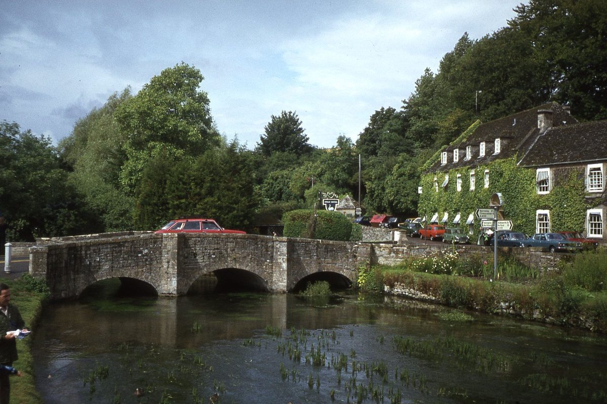
Bibury is the village William Morris supposedly called the most beautiful in England, and Arlington Row — that line of steep-gabled 17th-century weavers’ cottages — is the single most photographed street in the country. The short riverside stroll here is barely a walk at all: follow the River Coln past Rack Isle (the old water meadow where wool was hung to dry) and along to Arlington Row in a gentle loop of a mile or two. It’s flat, mostly firm underfoot, and doable in trainers in dry weather.
Two honest notes. First, the cottages are private homes — you admire from the lane, you don’t go in. Second, Bibury gets very busy at midday; go early morning or late afternoon for that hushed, mist-on-the-river version everyone’s chasing. Bibury is one of several show-stoppers I rank in the best Cotswolds villages guide.
If you want more than a stroll, extend to the circular route that joins Bibury with the neighbouring village of Coln St Aldwyns — around 6.5 miles, easy to moderate, with riverside paths, a bit of woodland and gentle countryside, plus a pub at each end. It’s one of my favourite “easy but proper” half-days in the southern part of the region.
Stow-on-the-Wold to Lower Slaughter
A quieter alternative to the Bourton route, this one starts in the handsome hilltop market town of Stow-on-the-Wold and drops gently downhill across wildflower meadows to Lower Slaughter — around 3 miles each way. Because it descends on the way out, you’ve a steady (but very manageable) climb back up to Stow, so it’s a notch above pancake-flat. Stow has the best pubs and antique shops for an end-of-walk reward, and the meadow scenery in early summer is glorious. Boots after rain, as ever; some of the field sections hold water.
Half-Day Classics: The Best Cotswold Way Walks
The Cotswold Way is England’s grand 102-mile National Trail, running from Chipping Campden all the way south to the city of Bath. Walking the whole thing takes most people six to ten days — but here’s the liberating bit for visitors: you don’t have to. The trail is broken into natural day sections of roughly 6 to 10 miles, and there’s a network of 15-or-so official Cotswold Way circular walks ranging from about 2.5 to 6 miles that loop you back to your start while showing off the prettiest stretches. These are, for my money, the best Cotswold Way walks for anyone not committing to the full thru-hike.
Broadway to Broadway Tower
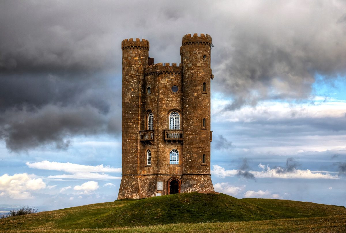
If you want one walk that delivers a “wow,” it’s this. From the broad, elegant high street of Broadway, the Cotswold Way climbs steadily uphill to Broadway Tower — a folly perched on the second-highest point in the Cotswolds, with views that on a clear day reach across many counties. It’s around a mile of mostly uphill walking to the tower itself; the popular circular route back makes it about 4 miles round trip, taking roughly two to three hours plus tower time.
I’ll be straight with you: it’s labelled moderate for a reason. The climb out of Broadway is a proper steady pull that’ll have you warm and possibly puffing — but there’s nothing technical, and you can take it as slowly as you like. The reward at the top is genuinely one of the best views in southern England. Bring water, and follow the white acorn waymarks.
Chipping Campden to Broadway
This is the opening section of the Cotswold Way and a cracking half-day in its own right — around 6 miles point to point, taking most walkers a little under three hours. You start at the famous arched Market Hall in Chipping Campden, climb up onto Dover’s Hill (a natural amphitheatre with a big-sky escarpment view), and follow the ridge southwest, eventually dropping toward Broadway, often passing Broadway Tower on the way. It’s moderate: a fair bit of up and down, but on good, well-signed paths.
Because it’s linear, you’ll want to think about getting back to your car or base — the local buses do connect Chipping Campden and Broadway, and the seasoned tip is to do the bus leg at the start of your day so you’re never racing a timetable on tired legs. I’ve worked through the car-free logistics for the whole region in the Cotswolds without a car guide, which is worth a read if you’re relying on public transport.
Stanton, Stanway and Snowshill Circular
This loop links three of the most achingly pretty, least-spoilt villages in the northern Cotswolds, and it follows the Cotswold Way for part of the way. It’s around 6.3 miles with a fair bit of climbing (call it three to three and a half hours), so I’d rate it moderate — a step up from the easy strolls, but hugely rewarding.
Starting from the car park in Stanton (one of the most perfectly preserved villages anywhere), you head south toward Stanway, home to a Jacobean manor famous for Britain’s tallest fountain. The route then climbs through woodland to Snowshill — a tiny, photogenic village with a quirky National Trust manor stuffed full of one collector’s eccentric treasures — before crossing Shenberrow Hill (with its Iron Age hillfort) and descending back to Stanton. The mix of villages, woods, hill forts and ridge views packs more variety into six miles than almost anything else here.
Fuller-Day Cotswold Walks for Keen Walkers
Got a whole day and decent legs? These deliver more distance and more solitude, while keeping the difficulty firmly in “rewarding” rather than “punishing” territory. This is hill-country walking, not mountain walking — but the Cotswold Way’s habit of repeatedly climbing up onto the escarpment and dropping back down means the ascent adds up. Eat well at breakfast.
Chipping Campden to Broadway, the Circular Way
If you loved the linear Chipping Campden to Broadway section but don’t fancy the bus, there’s a satisfying circular version — roughly 10 to 11 miles depending on the variant (some loop via the hamlet of Saintbury), with a good chunk of ascent and around five to five and a half hours of walking. You get Dover’s Hill, the ridge, Broadway, and a return through quiet farmland, all on a single loop back to your car at Chipping Campden’s Market Hall. It’s a full day, but a glorious one, and Chipping Campden is a wonderful place to flop afterwards.
The Winchcombe Loops
The handsome small town of Winchcombe bills itself as something of a walking capital, and it sits at the crossroads of several trails, including the Cotswold Way. There’s a celebrated long figure-of-eight route centred on the town (the full thing runs to many miles, but it’s designed to be split), passing the medieval Sudeley Castle and threading through the kind of empty, rolling sheep country that feels a world away from the busy honeypot villages. You can carve off a half-day or commit to a big day depending on your appetite. It’s the spot I’d point a keen walker who’s already ticked off the famous villages and wants something quieter.
Building Your Own Multi-Village Day
One of the joys of this landscape is that the villages sit close together, linked by an ancient web of footpaths and bridleways — many following routes walked for centuries. Once you’re comfortable with a map or route app, you can string villages into your own day: Stow to the Slaughters to Bourton, say, or a chain through the Coln valley. This is exactly the kind of unhurried, on-foot exploring I champion in my slow travel England itinerary — and if you want a ready-made framework, the two-day Cotswolds itinerary blends walks with the must-see villages.
Where to Base Yourself for Walking
The single biggest thing that makes a walking trip here relaxed is staying somewhere you can step out of the door and onto a footpath. Broadway, Chipping Campden, Stow-on-the-Wold and Bourton-on-the-Water are all superb walking bases in the north — each puts several routes on this page within easy reach. Bibury and the Coln valley work well for the south. I’ve broken down neighbourhoods, villages and the best inns to walk from in where to stay in the Cotswolds, and the whole region — walks, villages, food and logistics — is pulled together in the main Cotswolds travel guide.
If the Cotswolds are one stop on a bigger trip, you might be weighing them against England’s more rugged hill country. The Lake District travel guide is the place to look if you want genuine mountains, and you can see how the Cotswolds slot into a wider route in my England itinerary and round-up of the best places to visit in England.
Final Thoughts
The Cotswolds reward you most when you slow right down and travel between the villages on foot. You don’t need to be a serious hiker, and you certainly don’t need to walk the whole Cotswold Way — start with an easy village stroll like Bourton to the Slaughters or the Bibury riverside, and if you catch the bug, graduate to a Cotswold Way day section or a fuller loop. Wear the right footwear, download your route before you lose signal, go in the shoulder season if you can, and be honest with yourself about the mud. Do that, and these gentle hills will hand you the quiet, golden version of England that day-trippers in coaches never quite reach.
Research and Source Notes
Routes, distances and difficulty ratings in this guide were cross-checked against multiple walking and trail resources in June 2026, and distances were deliberately rounded and hedged as “around” because published measurements vary between sources. Key references consulted include the official National Trails Cotswold Way pages and circular-walk leaflets, the Cotswolds National Landscape self-guided routes, Explore the Cotswolds route write-ups (Bourton-on-the-Water to the Slaughters, Broadway to Broadway Tower, Bibury and Coln St Aldwyns, and the Cotswold Way overview), AllTrails and komoot route data for the Chipping Campden to Broadway and Stanton–Stanway–Snowshill loops, and footwear, seasonality and difficulty guidance drawn from Macs Adventure, Countryfile, Wanderlust, 10Adventures and Tripadvisor Cotswolds forum discussions. Practical advice on navigation reflects the Ordnance Survey OS Maps app and the relevant OS Explorer sheets. Local conditions — especially mud, river levels and bus timetables — change with the season, so always check current information before you set out.
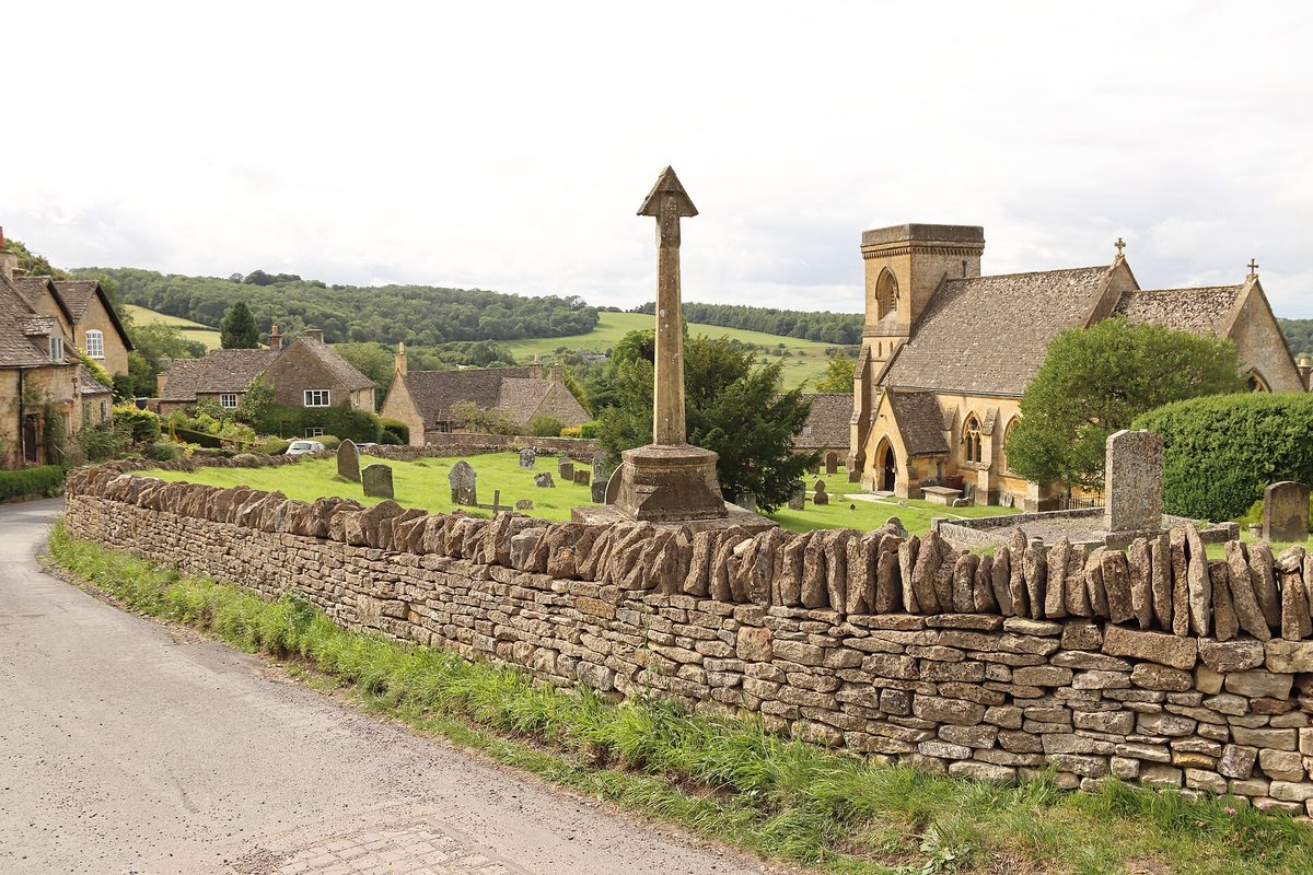
Photo Credits
- A waymarked Cotswold Way footpath climbing through golden farmland near Broadway — Photo: Ballista at English Wikipedia / CC BY-SA 3.0 via Wikimedia Commons. Source
- The River Eye flowing past honey-coloured cottages in Lower Slaughter — Photo: Michael Dibb / CC BY-SA 2.0 via Wikimedia Commons. Source
- Broadway Tower standing on its hilltop with sweeping Cotswold views — Photo: Craig Archer / CC BY-SA 4.0 via Wikimedia Commons. Source
- The River Coln winding past Arlington Row cottages and the old water meadow at Bibury — Photo: Colin Park / CC BY-SA 2.0 via Wikimedia Commons. Source
- The honey-stone cottages and gardens of Snowshill village in the northern Cotswolds — Photo: FrDr / CC BY-SA 4.0 via Wikimedia Commons. Source
Frequently asked questions
What is the easiest walk in the Cotswolds for beginners?
The easiest is Bourton-on-the-Water to Lower Slaughter and back — around 1.5 miles each way on a flat, clear riverside path. It’s pram-friendly in dry weather, suits all ages, and rewards you with one of the prettiest villages in England. After rain, swap trainers for boots, as the riverside sections get muddy in patches.
How long is the Cotswold Way and can I just do part of it?
The full Cotswold Way runs about 102 miles from Chipping Campden to Bath, taking most walkers six to ten days. You absolutely can do just part of it — the trail breaks into day sections of roughly 6 to 10 miles, and there are around 15 official circular walks (about 2.5 to 6 miles) that loop you back to your start along the best bits.
Are Cotswolds walks difficult or hilly?
Most popular routes are easy to moderate. The valley and village walks are gentle and nearly flat. The Cotswold Way is hillier than people expect — it repeatedly climbs onto the escarpment and back down, so the ascent adds up — but nothing is technical or mountainous. Take the climbs slowly and any reasonably fit visitor will be fine.
Do I need walking boots in the Cotswolds?
After any rain, yes — these are farmland footpaths that get genuinely muddy, and boots or sturdy lugged walking shoes will keep you upright and dry. In high summer after a dry spell, comfortable trainers are fine for the short village strolls. Whatever the season, pack a waterproof jacket; the weather changes fast.
When is the best time of year for walking in the Cotswolds?
April to October is the classic walking season, with May and September the sweet spot — settled weather, long days, and fewer crowds than the July–August peak. Spring is lush but wet underfoot; autumn brings golden woods but mud and shorter days. Winter walks are quiet and atmospheric, but expect very muddy, sometimes flooded paths.
Can I do Cotswolds walks without a car?
Yes, with a little planning. Towns like Chipping Campden, Broadway, Stow and Bourton are linked by local buses, so you can walk linear sections and ride back. The practical tip is to take the bus leg at the start of your walk, not the end, so you never race a timetable. My dedicated car-free guide covers the routes and timetables in detail.