Sheet 41 · Cornwall and Devon Travel Guide · 22 min read
Cornwall Road Trip Itinerary
A real Cornwall road trip itinerary: the full coastal loop, the roads that matter, narrow-lane road-craft, parking costs, fuel and EV, and the best
 Sheet 41
Contents 14 sections
The first time I drove the lane down to Porthcurno, I met a Land Rover coming the other way on a blind bend hemmed in by six-foot hedge-banks, and I reversed about eighty yards uphill with my wing mirror brushing fuchsia. That is Cornwall by car. Then you crest the hill, the Atlantic opens up below you in a sheet of turquoise, and you forgive the place everything.
This Cornwall road trip itinerary is not a tidy hour-by-hour plan. It is a route, the actual roads, and the road-craft — because the difference between a brilliant Cornish trip and a stressful one is almost entirely about how you drive it.
A Cornwall road trip itinerary at its best is a coastal loop: in via the A30, out along the north coast through Bude, Tintagel, Padstow, Newquay and St Ives, round Land’s End and the Penwith peninsula, then back along the south coast through Penzance, the Lizard, Falmouth, Fowey and Looe. Reckon on five to seven days and roughly 250 to 300 miles of driving, much of it slow and gorgeous.
For the wider region — where Cornwall ends and Devon begins, the weather, the why-go — start with my Cornwall and Devon travel guide. This piece is purely about the drive.
Quick Answer: Is a Cornwall road trip itinerary worth it?
Yes — driving is genuinely the best way to see Cornwall, because the good stuff hides at the end of single-track lanes no bus reaches. The classic Cornwall road trip itinerary is a clockwise coastal loop entering on the A30, running the north coast (Bude to St Ives), rounding Land’s End, and returning along the south coast (Penzance to Looe). Budget five to seven days, expect narrow lanes and summer queues, and pre-book or arrive early for parking.
If you would rather have a fixed day-by-day structure than a flexible loop, my 5 day Cornwall itinerary lays the trip out plan-style instead. This guide stays focused on the route and the road-craft.
At a glance: the Cornwall coastal loop in legs
| Leg | Route / roads | Driving time (no stops) | Highlights |
|---|---|---|---|
| Getting in | M5 to Exeter, then A30 across Bodmin Moor | 4.5–5.5 hrs from London to mid-Cornwall | The A30 spine; first sea views near Bodmin |
| Leg 1: North coast east | A39 Atlantic Highway: Bude → Tintagel → Padstow | ~1.5 hrs | Bude sea pool, Tintagel Castle, Padstow harbour |
| Leg 2: North coast west | A39/A3059 → Newquay → B3301 → St Ives | ~1.5 hrs | Bedruthan Steps, Newquay surf, St Ives |
| Leg 3: The far west | B3306 coast road, St Ives → Land’s End | ~1 hr (allow half a day) | Penwith, Cape Cornwall, Sennen, Land’s End |
| Leg 4: South coast west | A30/A394 → Penzance → A3083 Lizard → Falmouth | ~1.5 hrs | St Michael’s Mount, Kynance Cove, Falmouth |
| Leg 5: South coast east | A39/A390/B3359 → Fowey → Polperro → Looe | ~1.5 hrs | Fowey, Polperro, Looe, back to the A38 |
Drive times assume clear roads. In August, double the legs near St Ives, Padstow and the Lizard turn-offs — I am not exaggerating.
Getting in: the A30 is your spine, and you should respect it
There is really one way into Cornwall by car, and it is the A30. You come down the M5 past Exeter, the motorway ends near Exeter Airport, and the A30 takes over as a fast dual carriageway that runs the length of the county roughly down the middle, over Bodmin Moor and out toward Penzance. The A38 is the alternative southern route via Plymouth and the Tamar Bridge, useful if you are heading straight for the south-east corner around Looe and Fowey.
Two honest things about the A30. First, it is much better than it was. The Chiverton Cross to Carland Cross stretch was dualled in a roughly £330 million upgrade finished a couple of years back, and the old single-carriageway crawl near Truro is gone. Second, it still funnels the entire county’s holiday traffic onto one road, so on the worst summer Saturdays — historically the last two Saturdays of July, and most of August — it backs up badly at the pinch points around Loggans Moor near Hayle and the junctions for the bigger resorts.
My advice, learned the hard way: do your long arrival drive on a weekday if you possibly can, or set off stupidly early. Saturday is changeover day for holiday lets, so every cottage in Cornwall empties and refills at once, and the A30 wears it. If you are arriving on a Saturday, aim to be past Bodmin before mid-morning.
If you are coming from abroad and this is your first time on UK roads, read my driving in England for Americans guide before you set off — left-side driving, roundabouts, and the sheer narrowness take adjustment, and Cornwall is the deep end of the pool. For the rental side, renting a car in England covers what to book.
A note on the car you bring. Bring the smallest one you can live with. I will come back to this, but a compact hatchback is a joy in Cornwall and a large SUV or anything you are towing is a liability on the coastal lanes.
Leg 1: The north coast east — the A39 Atlantic Highway, Bude to Padstow
Once you peel off the A30 onto the A39, the trip properly begins. The A39 along the north coast is informally the Atlantic Highway — a roughly 70-mile run that starts back in Barnstaple in Devon and threads down through north Cornwall. It is a proper road, mostly two lanes, with the moor on one side and glimpses of the sea on the other, and it makes a far prettier entrance than grinding all the way down the A30.
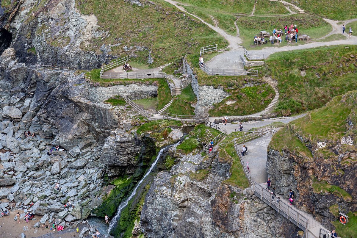
I usually start a clockwise loop at Bude, an honest, slightly windswept surf town with a sea pool carved into the rocks. From there the A39 runs south-west. The detour I never skip is Tintagel — turn off onto the B3263 and wind down to the cliffs where the castle ruins straddle a headland linked by a footbridge, with all the King Arthur legend attached. Park up top and walk; the lanes right by the village are tight.
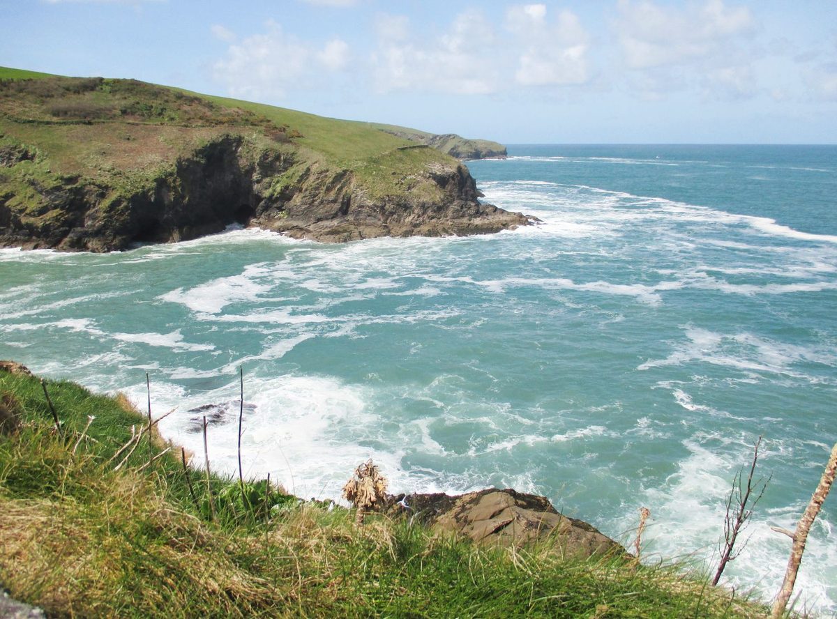
Then there is Port Isaac, the “Doc Martin” village, and here is your first hard lesson in Cornish road-craft: do not try to drive into the centre. The streets down to the harbour are barely wider than a car and frequently jammed with people on foot. Park in the big car park at the top of the hill and walk down. Every summer the local recovery firms make a small fortune from drivers who ignored this.
Carry on to Padstow, the foodie harbour town on the Camel estuary. It is lovely and it is busy, and the approach roads choke in season. There is decent pay-and-display parking on the way in; use it rather than nosing toward the quay. Across the estuary sits Rock, reachable by a little passenger ferry if you fancy leaving the car entirely for an afternoon.
For which beaches actually merit a stop along here, I defer to my best beaches in Cornwall guide — this is a driving piece, so I will keep nudging you to it rather than describing every cove.
Leg 2: The north coast west — Bedruthan, Newquay and the run to St Ives
South of Padstow the coast gets dramatic. Bedruthan Steps is the postcard: a string of sea stacks marching down a beach below high cliffs, with a National Trust car park up top and a cliff-path view that costs nothing. It is right on the B3276 coast road and worth the short detour off the A39.
Newquay is the surf capital and the closest thing Cornwall has to a party town. You either want it or you do not; for a road-tripper it is a useful refuel-and-stretch point with plenty of parking, fuel and supermarkets, which gets scarcer further west. Newquay is about an hour from Bude and roughly forty minutes from St Ives, to give you a sense of scale.
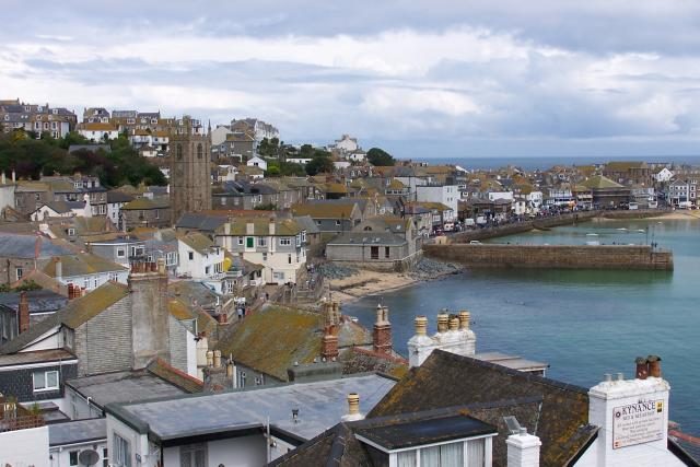
The drive on toward St Ives can go two ways. The fast way rejoins the A30. The pretty way hugs the coast through villages and along the B-roads, slower but far nicer if you are not in a rush. St Ives itself is the jewel of the north coast — turquoise water, a working harbour, Tate St Ives, light that painters have chased for a century.
And St Ives is where parking becomes a genuine event. Do not drive into the town centre. The streets are medieval-tight and largely pedestrianised, and the descent into town in August is a slow-motion ordeal. Use one of the big Cornwall Council long-stay car parks on the approach — Trenwith (the largest, with hundreds of spaces in peak season), Station, or Park Avenue — and walk in or hop the little branch-line train. Short-stay charges run somewhere around £2.30 to £5.80 for three hours, and a day in high season is roughly £9 or more, as of 2026. Honestly, the smartest move for St Ives is the park-and-ride: leave the car at Lelant Saltings or St Erth and take the scenic St Ives Bay branch line in, which Great Western Railway runs along one of the prettiest stretches of railway in Britain.
Leg 3: The far west — the B3306, the best driving road in Cornwall
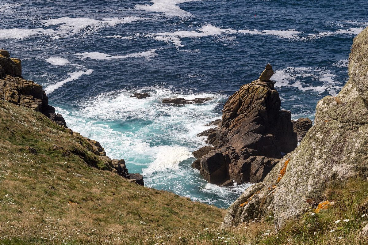
This is my favourite stretch in the whole county and the reason I keep coming back. From St Ives, instead of cutting across to Land’s End on the A30, take the B3306 coast road west toward St Just. It is about thirteen miles, single carriageway and often single-track, and it is regularly called one of the greatest driving roads in the United Kingdom. You get the Celtic Sea on your right and bare moorland on your left, ruined tin-mine engine houses standing on the clifftops, and barely a straight stretch the whole way.
It is also genuinely narrow and unforgiving in places, so this is where road-craft earns its keep. Go slow. Use the passing places. Expect to reverse. If you are nervous about single-track lanes, do this stretch early in the morning before the day-trippers wake up, and you will half the oncoming traffic.
Highlights to thread together: Zennor, a tiny moorland village with a mermaid legend and a famous pub; Cape Cornwall, the only “cape” in England and a quieter, wilder alternative to Land’s End; and St Just, the most westerly town in Britain, a good place to fuel up and grab a pasty before the final push.
Then Land’s End itself. The mainland’s most south-westerly point is a bit of a tourist circus at the visitor complex — there is a £6 or so car park charge to get in, as of 2026 — but walk away from the buildings along the cliff path and the scenery is the real thing. Just down the coast, Sennen Cove has a glorious surf beach and an easier drive in, and Porthcurno has the open-air Minack Theatre carved into the cliff. The lanes down to both are tight; take them gently.
Leg 4: The south coast west — Penzance, St Michael’s Mount and the Lizard
Round the tip of Penwith and the character of Cornwall changes. The south coast is softer, greener, more sheltered — palm trees in places, river estuaries, a Riviera feel.
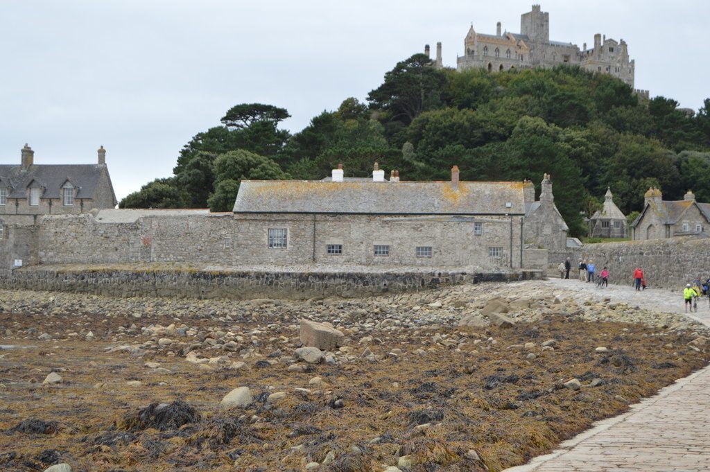
Penzance is the gateway and a proper town with everything a road-tripper needs. Just along the bay sits St Michael’s Mount, the tidal island with the castle, reachable on foot across a cobbled causeway at low tide or by boat at high tide — check the tide times, because they govern everything here. Park in Marazion and walk over.
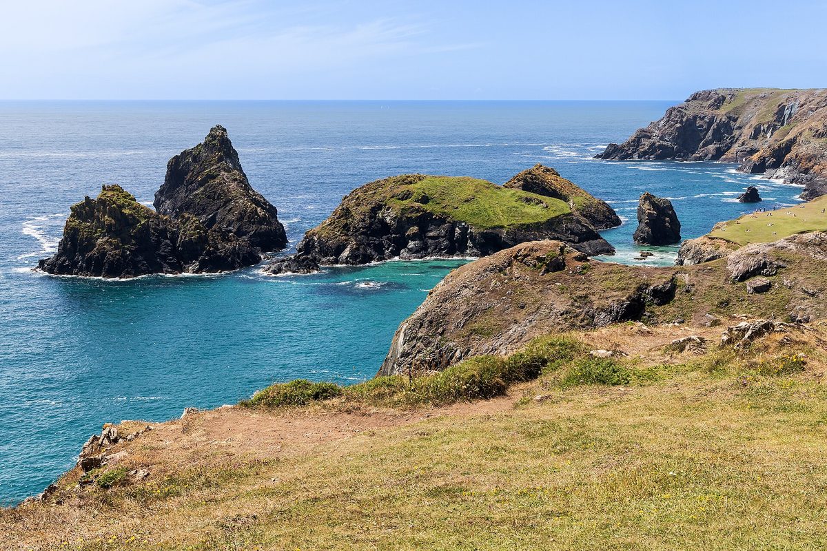
From here a brilliant detour is the Lizard peninsula, the most southerly land in mainland Britain. Take the A394 then the A3083 down past the Culdrose air base toward Lizard village. The unmissable stop is Kynance Cove — serpentine rock, white sand, water the colour of the Caribbean on a good day. There is a National Trust car park up top; it is free to members and somewhere around £8 for the day otherwise, as of 2026, and the walk down to the cove is steep but worth every step. Tuck the car in early; that car park fills by late morning in summer.
Loop back north toward Falmouth, a lively university and sailing town on a huge natural harbour, with the National Maritime Museum and a clutch of beaches. Falmouth is roughly thirty minutes from Penzance and makes an excellent base for the south coast. For where to lay your head along this coast, see where to stay in Cornwall.
A quieter detour I love near here is the Helford River — wooded creeks, the village of Helford with its little seasonal foot-ferry across to Helford Passage, and a deeply un-touristy calm. The lanes are narrow and leafy; you will not be going fast.
Leg 5: The south coast east — Fowey, Polperro and the run home
The last leg threads back east toward the county line. From the Truro/St Austell area the A390 and the smaller B-roads take you toward Fowey (say “Foy”), a steep, pretty harbour town stacked above a working river estuary. The streets are characteristically tight; park at the top and walk down, or use the long-stay car park on the approach. A little car ferry crosses the river to Bodinnick, and a passenger ferry runs to Polruan — both fun ways to extend the loop without grinding the car through narrow streets.
Then Polperro, and here is the rule again, written in stone: cars are banned from the village centre. You park in the large privately run car park at the top — coins only at the machines in my experience, somewhere around £7 for three hours and up to roughly £40 for a week, as of 2026 — and walk down the hill into one of the most photogenic fishing villages in England. There is even a little tuk-tuk shuttle that runs Easter to October if the walk is too much. Do not be the driver who tries to squeeze a car down toward the harbour; you will not fit, and you will hold up everyone behind you.
Finish at Looe, a cheerful twin-town resort split by a river, with a sandy beach and an easygoing seaside feel — a good final stop before you rejoin the A38 toward the Tamar Bridge and home. From Bude in the north to Looe in the south-east, the full coastal loop is somewhere around 250 to 300 miles depending on how many detours you take, with maybe eight to ten hours of pure driving spread across your days.
If a car ends up feeling like more hassle than it is worth, Cornwall is one of the few rural English destinations you can do partly carless — see Cornwall without a car for the train-and-bus version. But for this loop, the car is the point.
The road-craft: narrow lanes, passing places and reversing for tractors
Here is the section that matters most, and the one most itineraries skip. The driving in Cornwall is genuinely different, and going in prepared turns the stressful parts into the fun parts.
Most of Cornwall is single carriageway, and most of the interesting bits are single-track. Off the A30 and the A39, the lanes narrow fast, and the famous Cornish hedge-banks — earth walls topped with greenery, often six or eight feet high — sit right at the edge of the tarmac. You cannot see over them or through them, so you cannot see oncoming cars until you are nearly on top of each other.
The system, once you know it, is simple and civilised:
- Passing places are short widened bits of road, usually marked with a sign or a patch of gravel. When you meet an oncoming car, whoever is nearest a passing place uses it.
- If the passing place is on your left, pull into it. If it is on your right, stop opposite it and let the other car pull in — do not cross into the passing place on the right.
- Be ready to reverse. Sometimes the nearest passing place is behind you, and the courteous, correct thing is to back up to it. Yes, uphill, around a bend, for a tractor. It is normal here.
- A raised hand or a flash of the lights means “after you” or “thank you.” A friendly wave to the local who pulled in for you is basically the law.
Practical things that help enormously: keep your speed down — 20 to 30 mph on the lanes is plenty, and it gives you time to react. Use a low gear on the steep descents to coves so you are not riding the brakes. Tap the horn gently before truly blind bends on the tightest single-track lanes. And fold your mirrors in mentally — judge your width to the inch, because the hedges leave no margin.
The greenery plays a trick on you, by the way: lanes look narrower than they are because the foliage crowds in. There is usually more room than your nerves are telling you. Breathe, go slow, and you will be fine. My broader driving in England for Americans guide covers the general UK rules; what is above is the specifically-Cornish layer on top.
Big cars, motorhomes and towing: a genuine warning
I will be blunt, because every summer someone gets wedged. Cornwall’s coastal lanes are hostile to anything large. If you are renting, take the smallest car that fits your luggage and your family. A compact hatchback you can place precisely is worth more here than a big comfortable SUV you cannot.
Motorhomes and caravans need real planning. Anything over about six metres struggles on the lanes down to coves and into the old fishing villages, and the genuinely painful incidents make the local news — a motorhome wedged solid on a narrow Padstow street after blindly following a sat-nav, another stuck for hours trying to reach a tiny cove with hedges pressed against both flanks. The fix is straightforward: stick to the A-roads and main routes in anything big, do not let the sat-nav lure you down “shortcuts,” and check road suitability before you commit to a lane. Many coastal villages also restrict where motorhomes can park.
If you are towing a caravan, get the long arrival drive done off-peak, base yourself somewhere with easy A-road access, and use a smaller second vehicle or the buses to reach the tight spots. For the wider mechanics of a UK self-drive trip, including vehicle choice, renting a car in England is the place to start, and England road trips puts Cornwall in context with other routes around the country.
Parking realities and rough costs
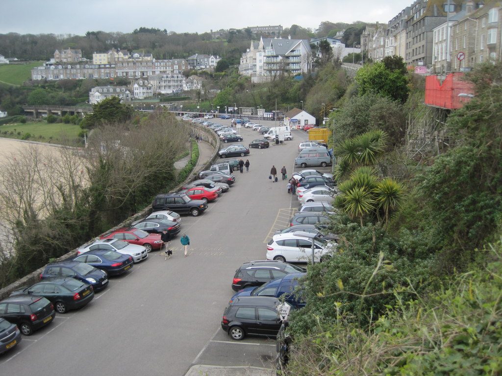
Parking is the running cost of a Cornwall road trip, and in the honeypot towns it is the daily puzzle. A few rules I live by:
- Arrive early or arrive resigned. The big car parks in St Ives, Padstow, around the Lizard and at the popular coves fill by mid-morning in summer. Get in before about 10am or have a plan B.
- Use the edge-of-town car parks, not the centre. Almost every pretty Cornish town wants you to park on the approach and walk in — St Ives, Padstow, Fowey, Polperro, Port Isaac all work this way, and several actively ban cars from the core.
- Rough costs, as of 2026: Cornwall Council car parks in the busy towns run somewhere around £2 to £6 for a couple of hours and roughly £9 or more for a full summer day. National Trust car parks at places like Kynance Cove are free to members and around £8 a day otherwise — National Trust membership pays for itself fast if you are touring the coast. Village car parks like Polperro’s are privately run and can want coins, so keep some change.
- Park-and-ride is your friend where it exists, especially for St Ives via the St Erth or Lelant Saltings branch line.
Honestly, factor £10 to £20 a day into your budget for parking across a touring trip. For the bigger picture on what a Cornwall trip costs, see England budget and costs.
Fuel and EV charging on the loop
Fuel is easy enough but thins out the further west you go. Fill up around the bigger towns — Bude, Newquay, St Ives, Penzance, Falmouth — rather than assuming you will find a station down a remote peninsula. Cornwall Services on the A30 (near Victoria/Roche, roughly mid-county) is the big one-stop on the way in or out, with fuel, food and chargers. Pump prices in remote Cornwall tend to run a touch higher than the national average, so top up on the A30 if you are price-sensitive.
EV charging in Cornwall has come a long way and is now perfectly workable for a road trip, though you should still plan rather than wing it. The good news: even Land’s End, the literal end of the line, now has rapid charging — an Osprey 150kW rapid that can add around 100 miles in 15 to 20 minutes, plus 43kW/50kW units at the visitor centre car park. Cornwall Services on the A30 has rapid chargers and makes an ideal top-up on arrival or departure. Around the towns you will find a mix of council car park chargers, supermarket units and en-route hubs.
My EV advice for this loop: arrive with a good charge, treat the A30 hubs as your reliable rapid points, and use slower destination chargers overnight at your accommodation where you can. The far-west peninsulas have fewer chargers than the central spine, so do your big top-ups on the A30 corridor and use the coast chargers as bonuses. A charging app or two on your phone is essential for live availability.
The best scenic detours (worth the extra miles)
If your loop has slack in it, these are the detours I would spend it on:
- The B3306 coast road, St Ives to St Just — covered above, but it bears repeating. The single best drive in Cornwall.
- The Lizard, A3083 down to Lizard Point and Kynance Cove — the most southerly road in mainland Britain, ending at serpentine cliffs and that impossible turquoise cove.
- The Roseland peninsula, via the King Harry Ferry — a chain ferry that crosses the Fal river and drops you onto a quiet, lush peninsula with the church-by-the-sea at St Just in Roseland. The ferry itself is a lovely, slightly surreal little experience.
- The Helford River lanes — leafy, hushed, creek-side driving south of Falmouth, ending at a foot-ferry and a waterside pub.
- The Atlantic Highway’s high moorland stretches on the A39 — when the road climbs away from the coast you get huge views over Bodmin Moor on one side and the sea on the other.
For more of the county’s quieter corners away from the obvious stops, hidden gems in England and most beautiful villages in England both feature Cornish entries, and best places to visit in Cornwall ranks the headline sights if you would rather prioritise than wander.
Final Thoughts
Driving Cornwall is the best and most maddening kind of road trip — the kind where the journey genuinely is the destination, because half the magic is the lane itself dropping you down through the hedges to a cove you would never have found otherwise.
My honest take after many trips: go in the smallest car you can, do the A30 stretches off-peak, and treat the narrow lanes as a feature rather than a fault. Slow right down, reverse for the tractor with good grace, give the local who pulled in for you a wave, and you will come home with the road-craft of a native. The B3306 round Penwith and the Lizard’s run down to Kynance are the two stretches I would drive again tomorrow.
For the rest of the country, England road trips and the England travel guide will point you onward, and best time to visit England will help you dodge the worst of the crowds. But Cornwall, driven well, is hard to beat.
Research and Source Notes
Drive times and distances cross-checked against mapping tools and confirmed against the route descriptions; treat all of them as “no-traffic” guides and add generously for summer. Road designations — the A30 as Cornwall’s main spine, the A39 as the informal Atlantic Highway, and the B3306 as the West Cornwall coast road — reflect standard references including the Cornwall Council highways pages and established route descriptions. A30 upgrade and congestion details (the Chiverton–Carland scheme, summer pinch points at Loggans Moor) draw on Cornwall Council and BBC News reporting.
Parking costs are hedged as “around / as of 2026” and based on Cornwall Council car park information, National Trust car park guidance (members park free at sites such as Kynance Cove), and the privately run village car parks at Polperro and Port Isaac; always check current tariffs on arrival, as they change seasonally. EV charging details reference site information for the Land’s End rapid hub and Cornwall Services, plus Cornwall EV charging guides — check live availability via a charging app before relying on any single point. For general motoring advice and breakdown cover, the AA and RAC are the standard UK sources; for park-and-ride context around St Ives, Great Western Railway (GWR) runs the St Erth–St Ives branch line. Destination and seasonal guidance draws on Visit Cornwall. Prices, ferry timetables and tide-dependent access (St Michael’s Mount, the Helford and Fowey ferries) all shift, so confirm specifics close to your trip.
Photo Credits
- Cornwall road trip itinerary coastal road approaching Land’s End on the Penwith peninsula — Photo: Dietmar Rabich / CC BY-SA 4.0 via Wikimedia Commons. Source)
- Driving around Cornwall: the harbour village of Port Isaac, best reached by parking at the top — Photo: Derek Voller / CC BY-SA 2.0 via Wikimedia Commons. Source
- Cornwall coastal drive views over Kynance Cove on the Lizard peninsula — Photo: Unukorno / CC BY 4.0 via Wikimedia Commons. Source
- Cornwall driving route stop at the clifftop ruins of Tintagel Castle on the north coast — Photo: Balon Greyjoy / CC BY-SA 4.0 via Wikimedia Commons. Source
- Cornwall by car: St Michael’s Mount across the causeway near Marazion — Photo: N Chadwick / CC BY-SA 2.0 via Wikimedia Commons. Source
Frequently asked questions
How many days do you need for a Cornwall road trip?
Five to seven days is the sweet spot for the full coastal loop. You can rush the highlights in three or four days, but the lanes are slow, parking eats time, and the whole pleasure of Cornwall is not hurrying. With a week you can drive the north coast, the far west and the south coast properly, with beach days and pub lunches built in rather than just ticking off viewpoints from the car.
Are the roads in Cornwall hard to drive?
The A-roads are fine; the coastal lanes are the challenge. Off the A30 and A39 you hit narrow single-track lanes with passing places and tall hedge-banks that hide oncoming traffic. It is not dangerous if you slow down, use the passing places and stay ready to reverse — but it rattles drivers used to wide roads. Take the smallest car you can, go gently, and it quickly becomes part of the fun.
What is the best route around Cornwall?
A clockwise coastal loop: enter on the A30, run the north coast via the A39 Atlantic Highway (Bude, Tintagel, Padstow, Newquay, St Ives), take the B3306 round Land's End, then return along the south coast (Penzance, the Lizard, Falmouth, Fowey, Looe). It strings together the best scenery, keeps the driving varied, and lets you base in two or three spots rather than packing and unpacking every night.
Is it worth driving to Cornwall?
Yes, if you want to reach the good stuff. Cornwall's best beaches, coves and villages sit at the end of lanes no bus serves, and a car gives you the freedom to chase tides, light and quieter corners. The trade-offs are summer traffic on the A30, fiddly parking and narrow lanes. If those put you off, Cornwall is unusually doable by train and bus instead, but driving unlocks the most.
When is the worst traffic in Cornwall?
Summer Saturdays are brutal because that is holiday changeover day — historically the last two Saturdays of July and most of August see the heaviest A30 queues, with pinch points around Hayle and the resort junctions. Drive your long arrival and departure legs midweek or very early if you can, and you will dodge the worst of it. Within the county, the honeypot car parks fill by mid-morning daily in peak season.
Can you drive a motorhome around Cornwall?
You can, but plan carefully and keep it on the main roads. Anything over about six metres struggles on the coastal lanes and into the old fishing villages, and sat-nav "shortcuts" regularly wedge motorhomes against hedges. Stick to the A-roads, check that any lane is suitable before committing, and use designated motorhome-friendly parking. A campervan is far easier to manage on Cornish lanes than a big motorhome.
1 note
Notes are closed on this sheet.