Sheet 12 · England Road Trips · 17 min read
Cornwall Road Trip
Plan a Cornwall road trip the smart way: the A30 and Atlantic Highway gateway, the wild north coast vs the gentle south, plus lane and parking tips.
 Sheet 12
Contents 10 sections
The hedge-banks are what nobody warns you about. You drop off the A30 onto some innocent-looking B-road, the satnav announces twelve minutes to the cove, and then the tarmac narrows to a single car’s width between two walls of granite and earth taller than your roof. A tractor appears. You reverse. A fuchsia branch combs your wing mirror. Then the lane spits you out at the top of a cliff, the Atlantic blazing turquoise below, and you sit there grinning like an idiot. That, more than any postcard, is Cornwall by car.
A Cornwall road trip is the best way to see England’s far southwest, because the harbours, coves and headlands are strung along a coast with almost no railway. Get down via the A30 or the Atlantic Highway, then work the wild north coast and the gentle south coast as two distinct characters, with the Land’s End loop between them.
I’ve driven this corner in every season and made every mistake going. Below is how I’d do it now, organised by coast and area rather than as a flat tick-list.
Quick Answer: How to plan a Cornwall road trip
Drive down on the A30 (faster, central spine) or the A39 Atlantic Highway (slower, scenic, via north Devon). Then treat Cornwall as two coasts: the rugged, surf-battered north (Bude, Tintagel, Padstow, Newquay, St Ives) and the softer, sheltered south (the Lizard, Falmouth, Fowey, Looe), joined by the Land’s End loop. Allow five to seven days, drive slowly, and arrive at popular coves before 10am.
At a glance: the route legs
Here’s the whole thing in one table. Drive times are rough and door-to-door in normal conditions — in July and August, add a serious margin, because the lanes clog up fast.
| Route leg / area | Roughly | Core drive time | Highlights |
|---|---|---|---|
| Gateway: London/M5 to Cornwall | 240–280 miles | 4.5–5.5 hrs (no stops) | A30 central spine, or A39 Atlantic Highway scenic |
| North coast: Bude to Padstow | ~35 miles | 1.5 hrs + stops | Bude, Boscastle, Tintagel, Port Isaac, Padstow |
| North coast: Padstow to St Ives | ~45 miles | 1.5 hrs + stops | Newquay, Bedruthan Steps, St Agnes, St Ives |
| Penwith / Land’s End loop | ~30 mile loop | Half to full day | St Ives, Land’s End, Sennen, Mousehole, Penzance |
| South-west: Penzance to the Lizard | ~30 miles | 1 hr + stops | St Michael’s Mount, Marazion, Kynance Cove, Lizard Point |
| South coast: Lizard to Falmouth | ~30 miles | 1 hr + stops | Helford, Falmouth, St Mawes (ferry), Roseland |
| South coast: Falmouth to Looe | ~45 miles | 1.5 hrs + stops | Mevagissey, Fowey, Polperro, Looe |
You don’t need to drive all of that in one trip — pick a coast, or split the week between them.
Getting there: the A30 vs the Atlantic Highway
Everything starts with the drive down, and you’ve got two genuinely different options once you’re past Exeter.
The A30: the fast spine
The A30 is the main artery. It runs the length of Cornwall from the Devon border at Launceston, past Bodmin, through the middle of the county and on to Land’s End. Most people take it because it’s dual carriageway for long stretches and simply the quickest way west. From London you’re looking at around 240 to 280 miles and, on a clear day, roughly four and a half to five and a half hours without stops, as of 2026.
The catch is “clear day” doing a lot of work. The A30 carries more traffic than any other road in Cornwall, and on a summer Saturday — changeover day for the holiday cottages — it can crawl. Travel on a weekday if you can, or leave stupidly early. I’ve done the Bodmin stretch at 6am with the road to myself and at noon on an August Saturday at walking pace.
Coming from the north or Midlands, you’ll likely join the A30 via the M5 to Exeter, the unofficial gateway. Fuel up and accept that everything west of here is slower than the map suggests.
The Atlantic Highway (A39): the scenic way in
The other option is the Atlantic Highway, the stretch of the A39 that runs around 70 miles from Barnstaple in north Devon down to the Newquay area, hugging the north coast through farmland, moor edges and big-sky country. It’s slower and largely single carriageway, but it’s a proper drive — far-reaching views, gentler traffic, and it drops you straight onto the north Cornwall coast rather than the middle of the county.
I’d take the A39 if the north coast is your priority and you’re not in a hurry. Come off the M5 around Tiverton, cut across to Barnstaple and pick up the highway there; you’ll pass the turnings for Clovelly and Hartland before you even cross into Cornwall near Bude. It rejoins the A30 briefly around Fraddon if you need the fast road later. My rule of thumb: A30 when you just want to arrive, Atlantic Highway when the journey is part of the holiday.
The north coast: wild, surfy and dramatic
This is the Cornwall of the brochures — big Atlantic swells, surf beaches, black cliffs, and fishing harbours wedged into impossible gaps in the rock. The north coast feels exposed and a bit untamed, and the driving reflects that: the connecting lanes between the headland villages are some of the narrowest you’ll meet.
Bude, Boscastle and Tintagel
If you’ve come in on the Atlantic Highway, Bude is your first proper Cornish stop — an easygoing surf town with a wide sandy bay, a sea pool carved into the rocks, and lifeguards in season. A softer introduction than what’s coming.
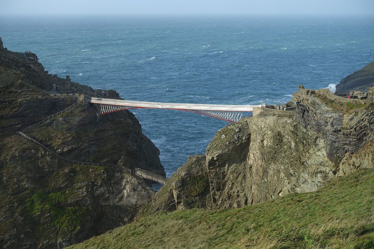
South from Bude the coast gets theatrical. Boscastle is a tiny harbour tucked into a steep, sheltered inlet, all stone cottages and a twisting entrance to the sea. Then Tintagel, where the ruined castle clings to a near-island headland linked by a dramatic footbridge — the legendary birthplace of King Arthur, run by English Heritage. Park in the village; the walk down is steep and the official car parks fill early.
A short hop on is Port Isaac, the impossibly photogenic fishing village you’ll recognise from television. One warning: don’t try to drive into the heart of it in summer. The lanes are tiny and the village car park sits up the hill for a reason. Park there and walk down.
Padstow, Rock and the Camel Estuary
Round the estuary you reach Padstow, a smart little harbour town that’s become a foodie magnet — Rick Stein’s name is on half the doorways. It’s lovely, and busy. The flat Camel Trail cycle route runs from here up to Wadebridge if you fancy a day out of the car.
Across the water sits Rock, all sailing and second homes, reachable by a little ferry from Padstow. You can drive between the two, but it’s a long loop inland via Wadebridge, so most people hop on the foot ferry.
Newquay, the surf coast and St Agnes
Newquay is the surf capital — Fistral Beach is the famous one, with proper Atlantic waves and a buzzy scene. It’s also the most commercial spot on this coast, so adjust your expectations. South of town, Bedruthan Steps is a National Trust clifftop car park overlooking a row of huge sea stacks marching out of the beach; the views are free and the stair access to the sand is seasonal.
Keep going and the coast quietens at St Agnes, a former mining village with the ruined engine houses of the tin industry stark against the cliffs at Wheal Coates. It’s one of my favourite stretches of the whole north coast — fewer crowds, brooding industrial-heritage drama, and a lovely beach at Trevaunance Cove (though parking there is tight and steep).
St Ives
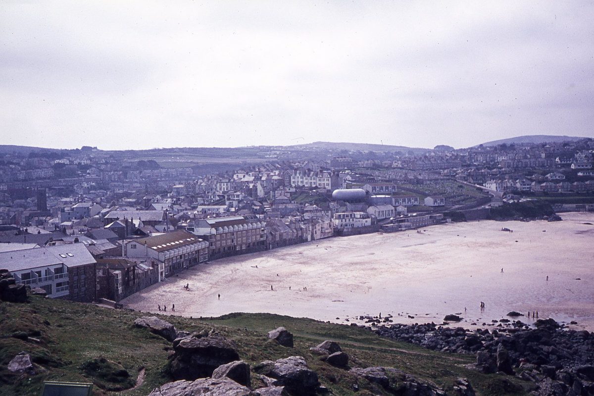
And then St Ives, the jewel of the north coast — a maze of cobbled lanes, a working harbour, white light that drew the artists (the Tate St Ives and the Barbara Hepworth garden are both here), and several gorgeous town beaches. It is also, in high summer, completely rammed.
This is the single most important parking tip in this article: do not drive into St Ives in summer. The town is a one-way bottleneck and you will lose an hour of your life and your sanity. Use the park-and-ride at Lelant Saltings, or take the branch-line train from St Erth — one of the prettiest short rail journeys in Britain, curving right along the coast above the sand. You’ll thank me.
The Land’s End loop: Penwith and St Michael’s Mount
At the far western tip, the county narrows into the Penwith peninsula, where you can make a satisfying loop linking the north and south coasts in a single day. This is, for my money, the most rewarding driving in Cornwall.
St Ives to Land’s End: the B3306
The B3306 runs the wild northern edge of Penwith from St Ives down towards Land’s End — about 13 miles of tight bends, blind dips and undulating moorland with the sea always on your right. It’s technical, slow and absolutely brilliant. You’ll pass Zennor (good pub, mermaid legend), the cliffs around Gurnard’s Head, and open moor scattered with ancient stones and old mine workings. Take it gently; there’s nowhere to overtake and you won’t want to.
Land’s End and Sennen
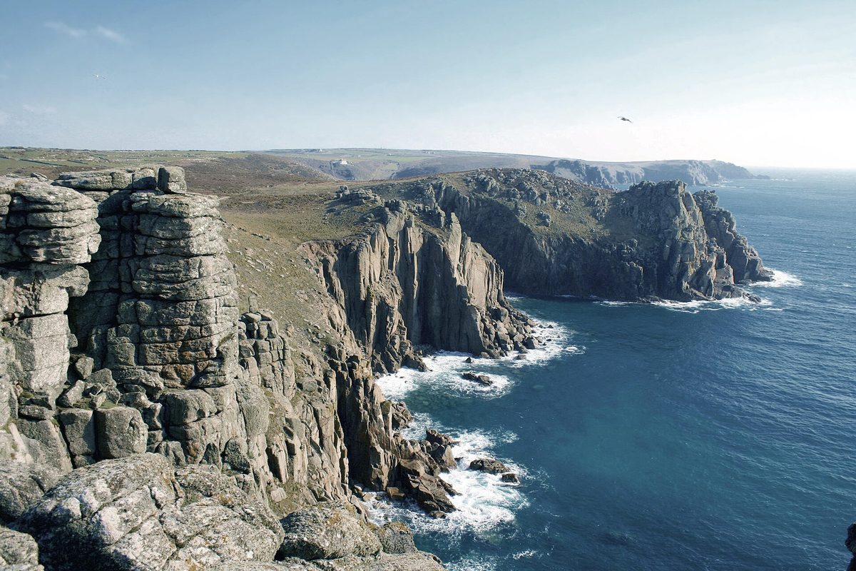
Land’s End itself is the most westerly point of mainland England, and I’ll be honest: the visitor complex there is a tatty little theme park you can skip. What you came for is the cliff. Walk a few hundred yards along the coast path away from the buildings and the granite headlands and Atlantic vastness reveal themselves, with the Longships lighthouse offshore.
Just north is Sennen Cove, with Whitesand Bay — a genuinely beautiful surf beach and a far nicer place to stop than Land’s End proper. South, the cliffs at Porthcurno hold the open-air Minack Theatre, carved into the rock above a turquoise cove; the lane down is narrow and the car parks fill by mid-morning.
Mousehole, Penzance and St Michael’s Mount
Curving back east along the south side of Penwith you reach Mousehole (say “Mowzel”), a tiny, perfect granite harbour. The lanes in are single-track and the village car park is small, so it backs up badly — park on the edge and walk in.
Penzance is the practical hub of the far west: a working town with good rail connections, ferries to the Isles of Scilly, and the lovely art-deco Jubilee Pool lido on the seafront, from where you’ll see the showstopper along the bay.
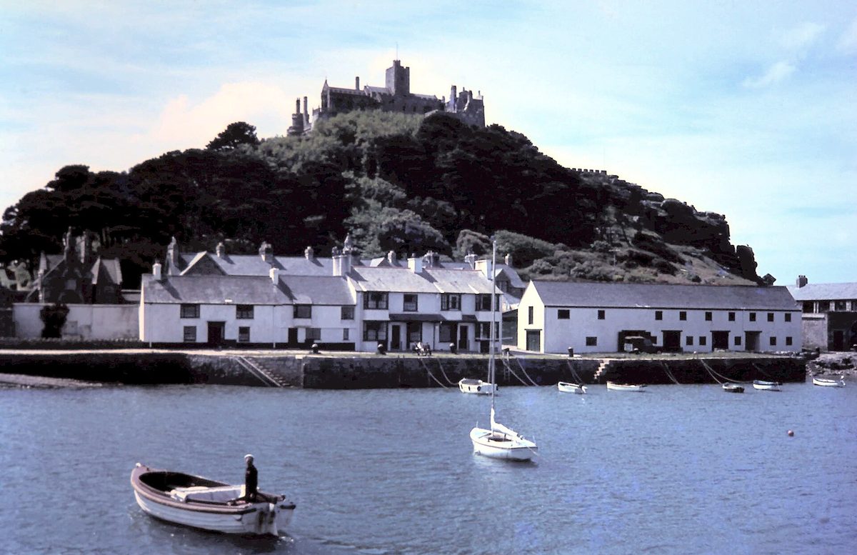
St Michael’s Mount is the tidal island crowned with a castle off Marazion, cared for by the National Trust and the family who still live there. The magic is the tide: when the sea is out you walk across a cobbled causeway; when it’s in, a little boat ferries you over (boats run roughly mid-March to October). Check the tide times first — the official site has a calculator. Parking is on the mainland at Marazion (Folly Field long-stay is the main one), and note there’s no free National Trust parking here, so everyone pays.
The south coast: gentle, green and sheltered
Cross to the south and Cornwall changes character entirely. The coast here looks onto the calmer English Channel, so the scenery softens: wooded creeks, sheltered coves, green fields running down to the water, and a string of historic fishing harbours. It’s gentler driving too — though “gentle” is relative, and the lanes are still lanes.
The Lizard
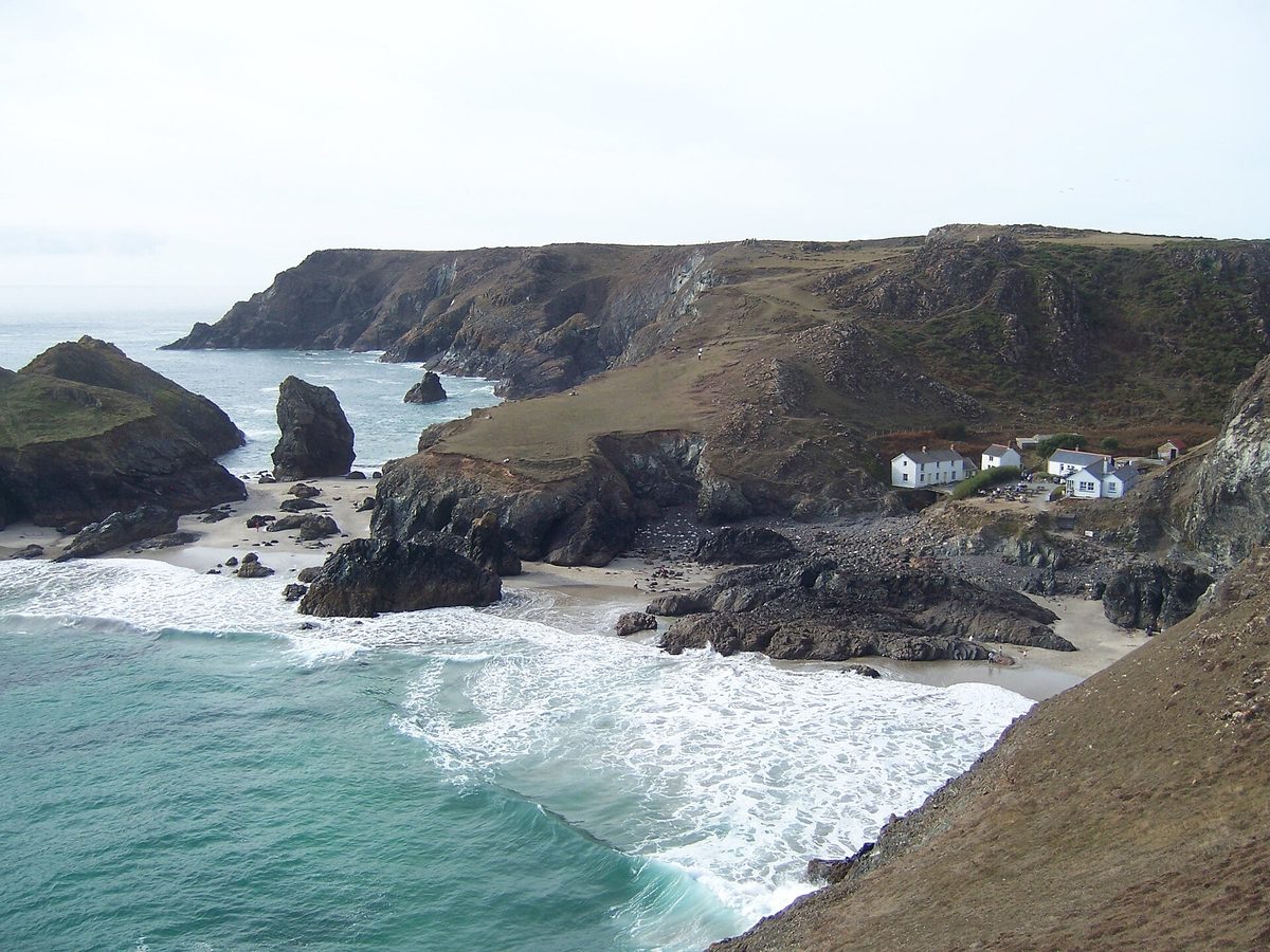
The Lizard peninsula is the southernmost point of mainland Britain, and home to my single favourite spot in Cornwall: Kynance Cove. Turquoise water, white sand, dark serpentine rock stacks — it looks tropical on a good day. The National Trust car park sits on the cliff above (pay-and-display, roughly £2 to £10 by season, free for members) and fills very early in summer, staying full into September. The walk down is steep, about ten minutes with steps at the bottom — not for everyone, but worth it.
A little further is Lizard Point itself, the actual tip, with a lighthouse and a clifftop café. Inland, Lizard village is the place to buy local serpentine trinkets and eat a pasty. Don’t rush this peninsula — the lanes are narrow and the rewards are scattered.
Falmouth, St Mawes and the Roseland
Falmouth is the liveliest town on the south coast — a university, the excellent National Maritime Museum Cornwall, one of the deepest natural harbours in the world, and a proper food scene. Gyllyngvase is its gentle town beach, calm water and cafés on the sand, ideal for an easy swim after the dramatic Atlantic stuff up north.
From Falmouth, hop the passenger ferry across the Carrick Roads to St Mawes, one of the prettiest villages in Cornwall, with a Tudor castle (English Heritage) guarding the harbour. By car it’s a long way round on the gorgeous Roseland peninsula — don’t miss the tiny waterside church of St Just in Roseland, set in subtropical gardens above a creek. The King Harry Ferry, a chain ferry across the River Fal, is a fun shortcut that saves a big inland loop.
Mevagissey, Fowey, Polperro and Looe
East of St Austell the harbour villages come thick and fast. Mevagissey is a genuine working fishing port, two harbours deep, with narrow streets and colourful boats — park up top and walk down. Nearby are the Lost Gardens of Heligan and, just inland, the Eden Project with its giant biome domes, a good rainy-day option.
Fowey (say “Foy”) is a smart, steep little estuary town with literary credentials — Daphne du Maurier country — and good restaurants. Polperro is almost absurdly picturesque, a smugglers’ harbour squeezed into a cleft; cars are banned from the centre, so you park at the top and walk in, exactly as it should be. And Looe, split into East and West by its river, is the cheerful bucket-and-spade family town of the lot, big on fresh seafood.
The lanes here are friendlier than Penwith’s but still single-track in places, and every village has the same arrangement: a car park at the top, a walk down, and chaos for anyone who ignores it.
North vs south: which coast for your road trip?
If you have to choose, here’s how I’d split it. Go north for drama: the biggest cliffs, the best surf (Fistral, Sennen, Polzeath), the most famous beaches, and wild Atlantic exposure — Tintagel, St Ives and the Land’s End loop are all up here. The trade-off is bigger crowds and stronger rip currents, so swimming is less casual. Go south for gentler: sheltered swimming, wooded creeks, the harbour-village string of Fowey, Polperro and Mevagissey, and Kynance Cove on the Lizard. It’s calmer and generally better for families and easy beach days.
The honest answer for a week is do both, using the Land’s End loop and the Lizard as the hinge between them. Base two or three nights near St Ives or Padstow for the north, then near Falmouth or Fowey for the south, and you barely double back. For where to stay on each coast, see my Cornwall accommodation guide.
Driving in Cornwall: the honest realities
Let me be blunt about the part the glossy guides skip, because it’s the difference between loving Cornwall and cursing it.
The lanes are genuinely narrow. Away from the A30 and A39, expect single-track roads bounded by high stone-and-earth hedge-banks with no visibility and no verge. You will meet oncoming cars. The drill: pull into a passing place on your left, or reverse to one if the other driver can’t. Tuck your mirrors in on the tightest stretches, give way to traffic coming uphill, and don’t tailgate — half the stress comes from people rushing. A smaller car is a real advantage.
Summer traffic is the real enemy. The A30 clogs on weekends, and the lanes into honeypot villages — Mousehole, St Ives, Polperro — back up for ages. My fixes: travel midweek, be parked at any popular cove by 9.30 or 10am, and use park-and-rides and ferries where they exist.
Parking is pay-and-display and increasingly cashless. Most beach and cove car parks charge roughly £3 to £8 a day, more at the busiest spots, as of 2026. Download the RingGo and JustPark apps before you go, because more machines have ditched coins. If you’re here a week and plan to hit National Trust sites — Kynance, Bedruthan, Lizard Point — annual membership can pay for itself in free parking alone. Never park on the verges or in the lanes; you’ll block emergency access and may get a ticket.
Fuel and EV: fill up on the A30 corridor, as petrol stations thin out fast on the back roads, and EV charging is patchier in deep Penwith than in the towns — plan charges around Truro and Penzance. If you’re hiring a vehicle, my guide to hiring a car covers the practical side, and a small hatchback really is the right call for Cornish lanes.
How this fits a bigger trip
A Cornwall loop slots neatly into a wider holiday. Most people pair it with Devon on the way down — the Cornwall and Devon travel guide covers that combination, and Devon vs Cornwall lays out the differences if you’re choosing between the two.
This article is hyper-local to Cornwall (with the Devon gateway). To fold Cornwall into a broader southern circuit through Dorset and Wessex, see the South England road trip plan; a grand tour of the whole country belongs to the England road trip itinerary for 10 days. My England road trips hub pulls all the routes together, and driving distances in England helps you sanity-check the legs.
For a day-by-day plan instead of this coast-by-coast overview, the Cornwall road trip itinerary and Cornwall 5-day itinerary break it into structured days, and for the beaches, see the best beaches in Cornwall.
Final Thoughts
Cornwall punishes people who treat it like a checklist and rewards people who slow down. My early-trip mistake was trying to “do” both coasts in a long weekend, zigzagging on the A30 and arriving at every beach at noon to find the car park full and my patience gone. The county only opened up once I accepted its pace: one coast at a time, off the main road by mid-morning, mirrors tucked in, a pasty in the glovebox.
Do that and a Cornwall road trip becomes one of the great drives in Britain. You crest a hedge-banked lane, the Atlantic explodes into view, and the reversing and the traffic and the £6 car park all stop mattering. Take the north for its drama and the south for its calm, link them through Land’s End, and give yourself time to get gloriously, happily lost.
Research and Source Notes
Route details, distances and prices were checked against official sources and reflect conditions as of 2026; always verify tide times, opening hours and parking charges before you travel, as these change seasonally.
- Visit Cornwall — regional overviews of the north and south coasts, scenic drives and town guides.
- National Trust — visiting and parking information for Kynance Cove, the Lizard, Bedruthan Steps and St Michael’s Mount.
- St Michael’s Mount official site — causeway and tide-crossing times and access details.
- English Heritage — Tintagel Castle and St Mawes Castle directions and opening times.
- VisitBritain — wider context on travelling in the southwest of England.
Photo Credits
- St Michael’s Mount rising from Mount’s Bay near Marazion, an iconic stop on a Cornwall road trip — Photo: Gordon Spicer / CC BY-SA 2.0 via Wikimedia Commons. Source
- The clifftop ruins of Tintagel Castle on the rugged north Cornwall coast — Photo: Kmtextor / CC BY-SA 4.0 via Wikimedia Commons. Source
- The harbour and rooftops of St Ives, the artistic heart of the north Cornwall coast — Photo: Colin Park / CC BY-SA 2.0 via Wikimedia Commons. Source
- The granite cliffs and Atlantic views at Land’s End, the most westerly point of mainland England — Photo: Keven Law from Los Angeles, USA / CC BY-SA 2.0 via Wikimedia Commons. Source
- The turquoise water and serpentine rock stacks of Kynance Cove on the Lizard — Photo: Tommytrouble at English Wikipedia (CC0) via Wikimedia Commons. Source
Frequently asked questions
How many days do you need for a Cornwall road trip?
You can hit the highlights in three or four days, but five to seven is the sweet spot. That gives you time for one base on the north coast and one on the south, plus the Land's End loop, without driving every day. Cornwall is small — about 80 miles top to bottom — but the lanes make everything slower than the map suggests.
Is the north or south coast of Cornwall better for a road trip?
It depends what you want. The north coast is wilder and more dramatic, with the best surf and the most famous beaches and cliffs. The south coast is gentler and more sheltered, with calmer swimming and pretty fishing harbours. For a week, do both and use the Land's End loop and the Lizard as the link between them.
What is the Atlantic Highway in Cornwall?
The Atlantic Highway is the scenic stretch of the A39 running roughly 70 miles from Barnstaple in north Devon down towards the Newquay area of north Cornwall. It hugs the north coast with big sea and moorland views. It's slower than the A30 but a far more enjoyable drive, and it drops you straight onto the north coast.
Do I need a car to explore Cornwall?
For a road trip, yes — most of the coves, harbours and headlands aren't near a railway, so a car gives you real freedom. That said, the few rail branch lines (like St Erth to St Ives) and park-and-rides are genuinely useful for the most congested towns, where driving in is a mistake.
Where is the hardest driving in Cornwall?
The single-track lanes off the main roads, especially around Penwith and the approaches to small villages like Mousehole and Polperro, are the trickiest — narrow, hedged and with blind bends. The B3306 from St Ives to Land's End is the famous technical drive. Go slowly, use passing places, and a smaller car helps enormously.
When should I avoid driving in Cornwall?
Avoid summer Saturdays if you can — that's holiday changeover day, and the A30 can crawl for hours. Within any day, the worst congestion at popular spots is roughly 11am to 4pm, so arrive early. The shoulder seasons of late spring and early autumn give you far quieter roads and easier parking.